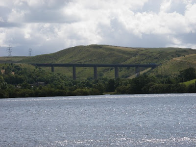
 Hollingworth Lake and the viaduct carrying the M62
"Over The Top" - of the Pennines, that is. Smithy Bridge to Todmorden. Lancashire to Yorkshire. This was another fine weather window in the summer that never was, 28th July 2007. First there was a short train journey to Smithy Bridge, going through the Summit Tunnel (interesting link
http://en.wikipedia.org/wiki/Summit_Tunnel_fire), then a walk around Hollingworth Lake before beginning the ascent up Blackstone Edge.
 Blackstone Edge viewed from Lydgate
Blackstone Edge is best known for being on the route of the Pennine Way. The opening of the route across this previously forbidden territory was much heralded at the time, but the reason for there being no historical right of way here soon became evident. Rather than the parsimony of landowners, the peaty terrain here cannot sustain a natural, "Worn" footpath, and within a decade of the Pennine Way opening this section of the route became an impassable quagmire. Now reinforced with paving slabs created from the rubble of demolished cotton mills, the damage on the adjacent old route is still clearly visible decades on.
 Going up the Roman Road
Previous generations knew better - an east-west route known as The Roman Road runs up towards Blackstone Edge. This is paved, with carved sections making up a drainage culvert running down the middle. The precise antiquity of this road is in dispute - Alfred Wainwright in paricular (in his Pennine Way Companion) champions the argument that it is a Medieval packhorse road rather than Roman. Certainly further along the route becomes known as The Old Packhorse Road, before becoming "Roman" again on the descent to Ripponden on the other side of the moor.
 Roman road? Wainwright said not...
At the top of the hill we left the Roman Road, turning left onto the Pennine Way. Visible in the distance from here is the White House pub, with an electricity pylon towering over it. Despite their despoiling effect on the landscape the chain of pylons disappearing over the horizon appears somewhat atmospheric, one of those imperfect juxtapositions of man with nature.

 The Pennine Way from here follows a track that services the reservoirs up here. Most of them were built around 1804 to provide water for the Rochdale Canal, though the last one, Warland reservoir, was opened in 1927 by the then Rochdale Corporation to supply its by then already declining cotton industry. Water stained yellow by the peat gushes into it from the moors above.
 Manchester viewed safely out of gunshot range
The view from here on this day was stunning - the city of Manchester clearly visible and beyond that Fidler's Ferry power station near Warrington. Through the haze on the horizon you could even make out the Welsh mountains in Snowdonia.
 Closeup - the CIS Tower clearly visible
 Warland Reservoir
 Monument at Withens Gate - Stoodley Pike in the background
Past Warland we got our first view of our old friend Stoodley Pike. As we walked towards it, it never seemed to get any closer, stubbornly remaining the same size on the near horizon. The rains over the summer had certainly left their mark on the slabbed Pennine Way route - much of it had sunk into the peat and was submerged. Winter walking in July...
Jo exclaimed at something she'd spotted in the Higher House Moor direction - The Red Arrows! Nice of them to salute us in this way. Must've been to mark our crossing the border into Yorkshire a mile or so back.
VIDEO: The Red Arrows Over Higher House Moor
 Into Calderdale
Eventually reaching Stoodley Pike we rested, surveying the scene over Calderdale. A steady descent from here to Lumbutts and Mankinoles, once the scene of rioting over the Poor Law repeal in the 1830s, hard to believe now on a peaceful, sunny day such as this.
 Strange birds - must be feeding on Ticks...
 Lumbutts Mill Water Wheel Tower
A further descent from the levelled off Lumbutts area saw us back in Todmorden just after 5pm, five and-a-half hours after setting off from Smithy Bridge, having done 12.2 miles. Our moving average though was only 2.6 mph (compared to 3 mph on the much longer Haworth-Hebden Bridge Walk), almost entirely due to being slowed down by the unseasonally boggy route over the very top.
 Andy's gig on the first night
 The abandoned Medieval village of Challacombe
 The pub!
 Norah silhouetted atmospherically against the Devon skyline
 One of the two bridges in Postbridge - this is the older one dating from the Middle Ages
  "Very nice. And tell me Mr Lee, why have you and the other villagers built that giant man made of twigs on the green?"
  The final, shocking statistics from Wednesday's walk
 Dartmoor ponies, Runnage Farm breed these
 For two days, this was home
 Has anybody else seen Southern Comfort?
 Following Geezer up the hill
 Hmmmm...
 Going beyond those rocks would be very, very foolish


