Tuesday 23 December 2008

Embsay Moor

Tuesday 6th May 2008


Craven and District Sailing Club out on Embsay Reservoir. The juxtaposition of Craven and sailing to me always seems a little odd - rather like discovering that there is a Cowes Mountaineering Club.

This was a very enjoyable evening walk starting at the car park at Embsay Reservoir near Skipton. We set off at 7.15pm in golden sunshine, aiming to be back by nightfall. However, with the walk being almost six miles, we would have to go at quite a brisk pace to achieve this. Thanks to some good surfaces (gravelled tracks make up much of the route on the actual moor) we made it back inside two hours.

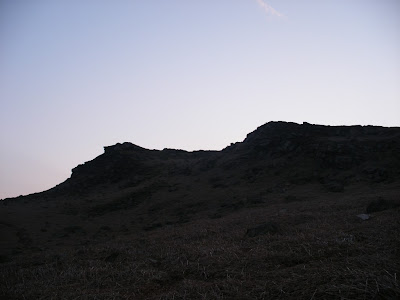
Embsay Crag

Neil on one of the excellent hard tracks that make up much of the route
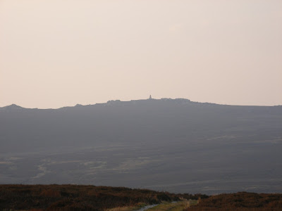

The war memorial on Cracoe Fell


A Neolithic hut on Embsay Moor?

Actually this is a shooting hut, to provide shelter for the grouse shooters in inclement weather


Inside the hut. Real luxury!


Sunset over Embsay Moor


Embsay Crag again...

...and again...

...and again


9pm - back to Embsay Reservoir. The boats have gone. The pub awaits...


Image produced from the Ordnance Survey Get-a-map service. Image reproduced with kind permission of Ordnance Survey and Ordnance Survey of Northern Ireland


Monday 22 December 2008

Brrrr!

White House - Todmorden Linear Walk
6th April 2008

The White House pub near Blackstone Edge

Continuing the review of some of 2008's minor excursions...

After all the recent snow it's worth recalling the heavy falls we had as late as April this year. Certainly this and last winter have seemed to have been more "Traditional" as far as freezing temperatures and snowfall are concerned.

This 7.5 mile linear walk covered most of the route taken in 2007's "Over The Top" post. On this occasion we started instead further on, at the White House pub near Blackstone Edge. Heavy snow was forecast for much of the country and we started under threatening skies. Much to our amazement it brightened up, before a heavy downfall was finally unleashed on us as we descended from Lumbutts. Fortunately the roads were still clear when Jo dropped Neil and I back at the car at The White House!


Arched footbridge over the drain from Warland Reservoir

This insignificant-looking beck is in fact the boundary between Lancashire (left) and Yorkshire (right).
Video:
Stopping for a break. Neil was looking for the football scores on his radio but only managed to find some annoying Mockney-intoning (I think they call it Estuary these days) Radio 1 DJ twittering on about snow in Streatham. None where we are, matey! (At least not yet...)


New-born lambs near Lumbutts


As we followed the Rochdale Canal the snow began to get heavier...

As we approached Jo's:


The White House car park after Jo had dropped us off back there

I doubt we'd have even bothered to start if it'd been like this earlier on...


Sunday 21 December 2008

Flasby Fell

27th February 2008


Flasby Fell

I've been a bit of a Big Time Charlie this year on the walks front, what with Hadrian's Wall, The Three Peaks etc, but there were (a few) shorter ones. Too few, in fact - the appalling weather put paid to quite a few prospective ventures. I'm not afraid of a bit of rain, but when faced with a climatological jet-hosing from the off (and no prospect of a let-up), well...

Pendle Hill

This 12-mile circular route from Skipton over Flasby Fell was quite good, done with Neil at the end of February. Stunning views from the top, though it's definitely a walk of two halves. We did it anti-clockwise, so had a rather long and boring walk along the Leeds-Liverpool Canal back to Skipton - here it was completely open, with the A65 only a few yards away at times, and you didn't seem to be getting anywhere. It might be better to do it clockwise, getting the boring bit out of the way first and instead having a gentle descent home down the fell. And watch yourself crossing the A59...

Neil approaching the summit


Broken Bench


Looking north west into the Yorkshire Dales National Park


The view across upper Airedale. Pendle Hill is on the left in the distance, Gargrave to the right of centre. The return route to Skipton along the Leeds-Liverpool Canal is just visible.

Image produced from the Ordnance Survey Get-a-map service. Image reproduced with kind permission of Ordnance Survey and Ordnance Survey of Northern Ireland


Whilst importing the Flasby video for editing, MovieMaker split the file as it was too large. I was faced with this (the point at which the second part begins) - thought I'd share it with you!

Summit Video:

Friday 12 December 2008

Dark Places

How Stean Gorge, 30th November 2008

The Gorge

The day after the Brimham walk we drove a few miles up the Nidd Valley to Lofthouse to visit How Stean Gorge. This (as I mentioned in the last post) is another oft-visited place when I was growing up, both with family and on school trips. This was another very frosty day, some thorough car de-icing was required before setting out. On arrival at How Stean there were some individuals emerging from their tents who had actually camped out the previous night - bikers, mostly. The grass on the site was white with frost, it couldn't have been too comfortable.


Today wasn't much of a walk, more of a caving trip - albeit a very mild one. Leading off from the Gorge is Tom Taylor's Cave, named after a notorious 18th Century local highwayman who used it as a hideout. Whilst dry, and not technically difficult, the cave was certainly more difficult than on the last visit that I could recall, a school trip in 1978. About half way in the passage narrows at around chest height, no problem for a child as this for them is around head-height and there is plenty of room. Unfortunately there was no other option for me but to get down on my hands and knees and crawl for some distance. Real adventure!

Alas no coins were found...


The signs warning about the dangers of slipping were not kidding - whilst attempting to take the shots of ice formations below I slipped and landed on my back with such speed that I barely registered what was happening - fortunately my rucksack padded the fall and prevented my head from striking the hard, rocky floor. I was only winded. A lucky escape...


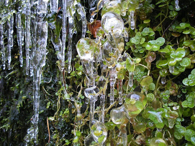
Strange ice formations caused by accruing water dripping from above


Icicles above the ice globules


Chain Saw carving of a lion

Tom Taylor's Cave

Bridge across the Gorge just prior to the cave's entrance


Ian by the light of three Light Emitting Diodes.


Emerging from the depths

Tom Taylor's Cave video:


How Stean Tunnel

Just as we had emerged from Tom Taylor's Cave and were contemplating tea at the cafeteria, one of the guides asked us if we had visited the "Other" cave. This sounded interesting...

Returning to the area down by the water where I had slipped, we then proceeded upstream via stepping stones to another passage, hidden from view from the normal Gorge trail. This also had a stream running through it, the only way to progress without getting wet feet was to stand astride it and edge slowly forwards. Easy for the six-foot guys of course...

Ian straddling the beck

Not so easy when you have little legs!


With our guide's assistance we made it through the passage to the end. Remarkably I still had dry feet at the end, despite some tricky manoeuvres being required at times. Not far from the end a switch-over was required, a little daunting but I managed to stay out of the water.


Di almost doing the splits

Doing a switch-over. Feet still dry!
A return journey was necessary as the tunnel leads to private land, though this was considerably easier than the outward one. It had been a good, unexpected workout. My legs ached quite a bit next day though, I'd been stretching muscles I probably didn't even realise I had in negotiating that passage. Mugs of tea had definitely been earned!

Damn...


Posing before going back

The innocuous-looking entrance to How Stean Tunnel

How Stean Tunnel video:


Saturday 6 December 2008

Pateley Bridge & Brimham Rocks

Pateley Bridge - Brimham Rocks & Back, 29th November 2008


High Street, Pateley Bridge

It's a while since I was last in Nidderdale, so it was nice to do this 8-mile walk to Brimham Rocks and back from Pateley Bridge. I think the last time I actually walked from Pateley Bridge was in 1984 as a 15 year-old cadet on an adventure training weekend with the Air Training Corps. Back then we'd been unexpectedly kicked out of the minibus at the top of the High Street (we were returning to our base at Blubberhouses Hall after completing another activity), given a map and a grid reference and told to make our way to it for a rendezvous. Our two accompanying adult observers ("ignore us, we're not here") were utterly dismayed when they saw that I (alone amongst my Bradfordian colleagues) knew immediately exactly where we were, thus negating the first part of the exercise (thanks Mum & Dad for all those trips to How Stean Gorge). They were also far from impressed that the route I chose to the rendezvous made use of metalled roads and firm tracks rather than the footpaths which were like quagmires after recent rain, resulting in a slightly longer but much faster journey. When we beat the rival group (dropped a quarter of a mile ahead of us, who had used the paths) to the finish it was all too much for them - nobody likes a smartarse. My refusal to play ball earned me some poor marks. It was about this time doubts about my suitability for a military career began to set in...


Frost on a wall at noon

Hard paths were to be the order of the day nearly a quarter of a century later too, whether we liked it or not. High Pressure lingering over the country meant freezing nights and not much warmer days, in glorious sunshine. The mudbaths we'd been wading through after another wet summer were frozen solid.


Along the Nidderdale Way

We followed the Nidderdale Way for most of the way to Brimham. This afforded good views of the Nidd valley, and some superb photo opportunities. Nidderdale is an Area Of Outstanding Natural Beauty (AONB), which is a protected area one step down from a National Park. Looking at a map, one wonders why it wasn't part of the adjoining Yorkshire Dales National Park on its establishment in 1954. I suspect that it is Nidderdale's tamer, more wooded and less bleak nature that excluded it. This isn't very rough country like The Dales, its reservoirs and woodland giving it a far more refined feel.


Frosty Leaves


"*Sigh* hurry up and take the photo..."


Frozen mud


Jo and frost-covered vegetation


Brimham Rocks is another place full of childhood memories. Picking bilberries amongst the strange gritstone formations, answering questions from puzzled Americans based at nearby Menwith Hill as to why we were doing it (Dad made wine with them, Mum made pies). Climbing cat-like up the knobbly rocks, then (equally cat-like) being unable to get down again and requiring an elaborate rescue, which usually required a half hour - though it seemed longer - of gentle coaching and ego-boosting as to my abilities and a promise that I'd be caught if I fell (the mortal danger would nowadays most definitely be the catcher's).


Formation at Brimham Rocks


Jo, me & Di (Photo: Ian Bonham)

This was also the scene of Air Training Corps activity for me - a terrifying 1983 abseil over a large overhang, following a not-so-terrifying earlier abseil down a sheer face. I decided at this point that I loved climbing, but hated descents - about as much use to a budding mountaineer as excellent take-offs but poor landings to a pilot. Oh well, back to the drawing board...


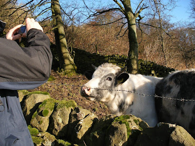
There were a couple of gangly young men in woolly hats wandering furtively amongst the formations, behaving rather not unlike those shifty-looking individuals you see trying car door-handles at night. They then started to climb - no ropes, no pitons, nothing. Yes, climbers ARE different. One of them let go and fell an awful long way, landing with a crash but got up unharmed. It transpired that he had a crash-mat. I initially thought that they were free-climbers, but in fact this activity is known as bouldering. I could have done with one of those mats 30 years ago...


Di & Ian


What does this remind you of?


Ewoks?

On our return along the Nidd we came across some strange-looking animals in a field - it took a moment or two to realise that they were actually sheep. They resembled Ewoks (of Return Of The Jedi fame) on four legs. I've been told that they look like Ryeland sheep, but I'm not sure. Certainly we watched them for a while, just in case they built an elaborate contraption from logs and rope to destroy any mechanical interlopers.


"You lookin' at me?"

Ewoks - The Movie (George Lucas will probably sue me for this...)


Darkness was already falling by 4pm when we returned, a sheet of ice beginning to form across the small reservoir between Glasshouses and Pateley Bridge.


It was a surprise in the evening to find that Pateley Bridge now has only two pubs in the centre, just as well they're both good ones. At least it spared us from too many trips out into the cold on a crawl!


Pateley Bridge at night

Di & Jo keeping warm whilst Ian withdraws some cash...