Friday, 28 September 2007

Mossdale - A Tragic Anniversary

Arthur C Clarke once queried if there was such a thing as a strange coincidence (presumably just another oxymoron to him), but on 23rd June 2007 we experienced just that. The Summer-That-Never-Was promised a window of opportunity to go on a full day's walk without getting wet, so we convened in Grassington in the Yorkshire Dales to do a 10-mile walk from one of Neil's walking books to Mossdale Scar and back.


The Grassington Festival was in full swing when we arrived, with a brass band in the Market Square. After vain enquiries as to whether tickets to see the lovely Hayley Westenra the following week were still available (sold out months before), and stocking up on home-made pasties and sausage rolls from the shop we set out towards the village of Conistone on the first leg of our journey.


After an interesting journey across limestone scenery we arrived in Conistone. A pretty Dales village, we lingered awhile and broke out the sausage rolls. A collie came up to us, hoping to scavenge a little bit for himself - Ian duly obliged. Something about the name Mossdale was troubling me, I'd heard it before - but where, and in what context? The answer lay a few yards away in the churchyard, but in our ignorance we pressed on out of the village. ..


A friendly dog in Conistone after our sausage rolls. Soon the postman arrived and we were forgotten.


After passing through some interesting limestone gorges and a scramble up onto some high moorland we stopped for lunch. In the distance we could now see Mossdale Scar, looking somewhat less remarkable than expected. From there we were to backtrack a while before turning south towards Grassington. What was so special about this place that it would form the turning point for a walk?
Jo goes the hard way.


Jo & Ian


On we went, my GPS counting down to a spot in front of a small limestone cliff - we were here alright. Neil expressed disappointment, and dug out his walk book to read about Mossdale Scar. It turned out that on 24th June 1967 - almost exactly 40 years before to the day - 10 cavers from the University Of Leeds Speliological Association (ULSA) entered the cave system to try and explore the far passages. Apparently Mossdale Caverns is a very dangerous system, often quoted as the caving equivalent of the North Wall of the Eiger. The reason for this is that besides being very difficult technically it is extremely prone to flooding, even after small amounts of rainfall. Four of the party gave up after 3 hours and returned to the surface, walking back to Conistone where the group had left their vehicles.

David Adamson, aged 26, was among those still underground. An English teacher at Foxwood School in Leeds, he appears to have been the leader of the expedition. An experienced caver, Adamson had made several notable passage discoveries with ULSA over the previous few years . His fiancee had been one of those who had given up earlier, and four hours later as night fell she returned to Mossdale Scar to check if they had surfaced yet. There had been a a severe thunderstorm in the intervening period, and to her horror she saw the waters of Mossdale Beck gushing down the sink hole of the caverns. She ran the two and a half miles across the moor back to Conistone in darkness to raise the alarm, but it was 2am the next day before the rescue could get underway. After an enormous 18-hour rescue operation involving mechanical excavators to divert the Beck and drain the 9,000 gallon lake which had formed at the entrance, 5 of the cavers were found drowned in a 2-foot high section of the Far Marathon passage. The sixth was found later further into the system. They appeared to have been on their way back out when the flood waters hit them.

Mossdale Scar

Retrieval of the bodies would have proved both difficult and dangerous, and the decision was taken to seal up with concrete the vertical entrance on the moorland above the scar that the six had used. Entry via the sink would still be possible however, and would be used by several covert explorations over the years.

In 1971, with the permission of the families of the dead (but without knowledge of the authorities), an ULSA expedition descended the caverns and moved the remains of the cavers to The Sanctuary, a higher level passage not prone to flooding and buried them there. In 1976 the sealed original entrance was opened up by a secret expedition. The landowners where Mossdale Scar stands are adamant that they will not allow any exploration, going so far as to refuse a camera crew from the BBC Yorks & Lincs regional programme Inside Out (making a feature on the 40th anniversary of the disaster) permission to film even the entrance to the caverns, saying it was too dangerous and would encourage further expeditions.


The sink hole from Mossdale Beck. Entry to the system is still possible from here (though NOT recommended)

The area outside of the cavern is, of course, not dangerous and despite the impression given by the BBC documentary (reduced to filming Mossdale Scar from the air to circumvent the restriction) it is perfectly legal to walk there, being situated on Access Land (even pre-CRoW a public right of way went within yards of the sink).


The cairn marking the spot where, hundreds of feet underneath, the bodies of the six cavers were found.
(Photo by Mick Melvin)

Very few people involved with the tragedy were prepared to talk to Inside Out. In particular the families, fellow cavers on the expedition and the villagers of Conistone all refused to be interviewed for the programme. (having been involved in a traumatic event myself - http://en.wikipedia.org/wiki/Bradford_City_disaster -this is understandable). The local vicar said in an interview that the event had left a deep scar on the village and that the local people talked about it surprisingly often.
Next to the formerly sealed entrance the six used a plaque is attached to a stone, inscribed with the following epitaph:


"In everlasting memory from the families of

David Adamson, aged 26.

Geoffrey Warren Boireau, aged 24.

William Frakes, aged 19.

John Ogden, aged 20.

Michael John Ryan, aged 17.

Colin Richard Vickers, aged 23


Who rest here in Mossdale Caverns where they died 24th June 1967.

I will lift up mine eyes unto the hills

From whence cometh my strength."

There is also a stone memorial in the churchyard at Conistone.

Heading back towards Grassington

Food for thought indeed for our trek back to Grassington. Back in the town the brass band had gone and there was street theatre. One of the actors gave us good reason to believe the late, great Oliver Reed might not be so late after all. How better to discuss the possibility than over a pint of Black Sheep..?

Filming where the BBC couldn't -
VIDEO - 4 min 29 sec:


Interesting Mossdale Tragedy Links

Yorkshire Post Article:

http://www.yorkshirepost.co.uk/news/Grim-anniversary-of-cavers39-descent.2978516.jp

Spirited defence of the expedition in the ULSA journal:

http://66.102.9.104/search?q=cache:X5h6EdlDLccJ:www.ulsa.org.uk/pubs/virtual/openFile.php%3Fpub_id%3D2+%22dave+adamson%22+caving&hl=en&ct=clnk&cd=2&gl=uk&ie=UTF-8

BBC Inside Out documentary broadcast to mark the 40th anniversary of the tragedy:

Friday, 21 September 2007

And If That Wasn't Enough... (Stoodley Pike, 4th March 2007)

Not content with our 17-mile jaunt from Haworth the day before, we assembled at Jo's house in Todmorden for a nice 6-mile Sunday morning stroll up to Stoodley Pike. Dry but overcast as we put our boots on, the weather would soon break and literally soak us to the skin. It was too much to be lucky with the rain two days running. Tea and cakes at Jo's afterwards never tasted so good.
Pausing for breath. As you can probably guess, the wind is coming from behind us
The 110-foot high Stoodley Pike Monument was originally constructed in 1814 to mark the end of the Napoleonic Wars. A magnet for lightning, a strike in 1854 caused it to collapse and the present structure was erected in 1856, commemorate the end of the Crimean War. A conductor has ensured no further damage despite being struck countless times since.

On the Pennine Way approaching The Pike
Taking advantage of the shelter afforded by the entrance
Descending towards Lumbutts
On the Rochdale canal, nearly home
Typically, the rain then stopped!

VIDEO: 2min 20 sec

Tuesday, 11 September 2007

Haworth - Hebden Bridge Walk 3rd March 2007

This is actually a 20-mile walk, consisting of a 17-mile circuit with a one and a half mile "stub" to Hebden Bridge along which you must also return. This being March, with sunset at 6pm, we decided to go for just the main route. Depart around 10.30, back around 6, that was the plan. Could we do it?
It wasn't a good start, various factors meaning we didn't get under way until 10.45. Still, we could make that up with a good pace. We proceeded down Haworth High Street, perched precipitously on the edge of the Worth Valley, then turned right at the Church, once ministered by the Reverend Patrick Bronte.

From here it was along the Bronte Way for a while, before veering off left across lush emerald pastures and through narrow gritstone stiles. The day's weather had looked as if it was going to be a little iffy and we hadn't gone too far when it started to rain. Beyond Leeshaw Reservoir this turned to sleet and it was through this, heads down, that we trudged up Stairs Hill.

Dale and Neil recovering at Top of Stairs

This is the first big climb of the walk, the summit being called Top of Stairs – it certainly felt like it! At least the tracks were good, so it wasn't too muddy underfoot.
Cock Hill Moor Research Station

Visible from here on the edge of Oxenhope Moor is the Waggon & Horses, also known as the Moorland Ale House from a more recent reincarnation. According to local Bradford folklore, this is the pub people would go to if they were having an affair. It’s not difficult to see why – this remote hostelry is the last pub in the Bradford District before Calderdale, which begins at the top of the desolate, windswept moor at Cock Hill. Here you would be safe, and unrecognised (or at least have the guarantee of mutually assured marital destruction in the event you were…!). Further along the horizon are the satellite dish and aerials of Bradford University’s Cock Hill research station, whose perimeter straddles the Borough boundary. When I was a boy this had a thrilling, space age look about it but in this modern age of ubiquitous Sky TV receivers somewhat less so. Now weather-beaten and covered in graffiti it looks rather ugly.


From here we descended along the side of Crimsworth Dean towards Hebden Bridge. The weather had now completely changed, the sun was shining and the last vestiges of cloud disappearing. Heptonstall Church is clearly visible on top of the spur which forms a middle horizon, and the needle of Stoodley Pike monument on the far horizon. There were now only three miles (and at the rate we were going, less than an hour) until lunch. After a fairly inauspicious start this was turning into a fine day. Waterproofs were removed and re-stowed in rucksacks, fleeces are unzipped and sunglasses donned. We merrily tramped along through National Trust woodland and eventually arrived at Horse Bridge and the car park. Several large logs and stones provided seating for lunch, and Cornish pasties and sausage rolls bought in Haworth were brought out. An Anthony Gormley-style statue carved from wood watched over us while we ate. We were now at a fork in the track – left was the route “Stub“ leading down the valley to Hebden Bridge, a 3-mile return journey. But this would push the total walk distance to an exhausting 20 miles and have meant the last hour would have been in darkness. Hebden is a fascinating town and the little time afforded by this detour could not do it justice – better on this occasion to continue right towards Gibson Mill and Hardcastle Crags.

Gibson Mill


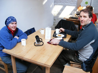
Jo and Neil in the muddy boot cafe in Gibson Mill


Gibson Mill is a visitor centre for Hardcastle Crags, built originally as a cotton mill in 1800 it is a fascinating place:


http://www.nationaltrust.org.uk/main/w-vh/w-visits/w-findaplace/w-hardcastlecrags/w-hardcastlecrags-gibsonmill_project.htm


Best of all it has a stone floored, naturally lit muddy boot cafe serving hot drinks and home-made cakes. This was a very welcome stop and very conveniently situated towards the middle of the route.

From here the route continued up a forest track past the crags, emerging within sight of Wadsworth Moor, across which lay our return route. The moor was bathed in golden afternoon sunshine and it was a very pleasant ascent.

Walshaw Reservoirs
At Walshaw Reservoirs we joined the slabbed Pennine Way, which snaked away to the north east and our next destination, the ruined farmhouse known as Top Withens. Before long we came across this memorial stone bearing the inscription "E. Wilkinson. A Rambler. Died Aug 31 1964, Aged 35." Taking the opportunity for a breather (puffing away at almost 3 years older), I contemplated this for a few moments. Whoever it was wasn't a Pennine Way walker, as that trail didn't come into existence until the following April. Did they die here? Or was this just a favourite spot? A mystery. (Subsequently I discovered - from Wainwright's Pennine Way Companion - that the stone was laid by the Spen Valley Ramblers. More on the memorial here: http://www.geograph.org.uk/photo/394604)

On the Pennine Way approaching Top Withens, visible centre-left

Onwards we marched, up the brow of the hill, the name "TOPWIT" (short for Top Withens) on my GPS, the distance to go counting down. 0.6 miles, 800 yards...still walking. 700 yards, 600 yards and we're at the brow of the hill...500, 400...and there it is! It seemed strange to see this familiar landmark from this angle. Normally the ruin, allegedly the inspiration for Emily Bronte's Wuthering Heights, marks the Ultima Thule for visitors to Bronte Country, before turning back for the comforts of Haworth. Certainly our arrival from an unusual direction attracted some interest from the few people there.

Top Withens
Contemplating the final strait

From here it was a straight 3.5 miles back to Haworth, and we had an hour and a quarter to do it in. The sun was setting as we walked over Penistone Hill and back down the hill towards the High St. Dale unfortunately pulled a muscle here (there can't be many Yorkshire hills that have bested a Scotsman...) But we had done it - and at some speed, a moving average of 3mph all the way round. And ahead lay a hot bath, hot food and an evening spent in the company of Mr Timothy Taylor...


Sunset view across Penistone Hill - half a mile to go

VIDEO: 3min 45sec

Tuesday, 4 September 2007

Attack Of The Killer Sheep

They're normally the most placid of creatures, but as The Walking Englishman discovered here http://www.walkingenglishman.com/westyorkshire04.htm (scroll down) where food (or the promise of it) is concerned, our woolly friends can become real pests or, as you'll see further down, downright aggressive.

The Blackface variety found in the popular Peak District and South Pennine areas seems to be the worst culprit. I'm not sure if it's just a naturally friendly and curious breed or whether it's generations of walkers feeding them, but you don't have to stop for long on footpaths in the Edale area before one will venture up to you.


This one approached us at The Swine's Back, near Kinder Low back in May 2005. Fortunately it wasn't too persistent (or maybe it just didn't like Ginster's Pasties). In February this year though at Lose Hill at the other end of the Vale Of Edale it was a different story. Sheep were crowding people like pet dogs, and one was actually putting its head in unattended rucksacks.


At Lose Hill poor Andrew gets some unwelcome attention!

The real problem area though, as shown in The Walking Englishaman's site, is Top Withens. This deserted farmhouse is very much part of the Bronte Country tourist trail (it is rumoured to have been the inspiration for Wuthering Heights) and as a consequence the sheep have become very accustomed to being fed.


"Sorry mate, this is just a Sunday afternoon walk so no food"

On my most recent visit in July one poor bloke was virtually mugged for his sandwiches. It was quite a busy afternoon for tourists so as a result was probably the most filmed event since the Kennedy Assasination in 1963. None of the footage from the many cameras seems to have popped up on Youtube, however the Turner Broadcasting Corporation (the smaller, UK version) had its camera there...


So remember, it's a jungle out there. No lions or tigers, just thousands upon thousands of sheep in wolves' clothing. Still, at least they're not trying to eat you. Yet...


"BOO!"


"We're gonna have you, mate..."