 This is actually a 20-mile walk, consisting of a 17-mile circuit with a one and a half mile "stub" to Hebden Bridge along which you must also return. This being March, with sunset at 6pm, we decided to go for just the main route. Depart around 10.30, back around 6, that was the plan. Could we do it?
It wasn't a good start, various factors meaning we didn't get under way until 10.45. Still, we could make that up with a good pace. We proceeded down Haworth High Street, perched precipitously on the edge of the Worth Valley, then turned right at the Church, once ministered by the Reverend Patrick Bronte.

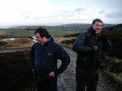
Dale and Neil recovering at Top of Stairs
This is the first big climb of the walk, the summit being called Top of Stairs – it certainly felt like it! At least the tracks were good, so it wasn't too muddy underfoot.
Visible from here on the edge of Oxenhope Moor is the Waggon & Horses, also known as the Moorland Ale House from a more recent reincarnation. According to local Bradford folklore, this is the pub people would go to if they were having an affair. It’s not difficult to see why – this remote hostelry is the last pub in the Bradford District before Calderdale, which begins at the top of the desolate, windswept moor at Cock Hill. Here you would be safe, and unrecognised (or at least have the guarantee of mutually assured marital destruction in the event you were…!). Further along the horizon are the satellite dish and aerials of Bradford University’s Cock Hill research station, whose perimeter straddles the Borough boundary. When I was a boy this had a thrilling, space age look about it but in this modern age of ubiquitous Sky TV receivers somewhat less so. Now weather-beaten and covered in graffiti it looks rather ugly.


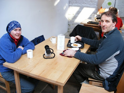
Jo and Neil in the muddy boot cafe in Gibson Mill
Gibson Mill is a visitor centre for Hardcastle Crags, built originally as a cotton mill in 1800 it is a fascinating place:
Best of all it has a stone floored, naturally lit muddy boot cafe serving hot drinks and home-made cakes. This was a very welcome stop and very conveniently situated towards the middle of the route.
From here the route continued up a forest track past the crags, emerging within sight of Wadsworth Moor, across which lay our return route. The moor was bathed in golden afternoon sunshine and it was a very pleasant ascent.


On the Pennine Way approaching Top Withens, visible centre-left
Onwards we marched, up the brow of the hill, the name "TOPWIT" (short for Top Withens) on my GPS, the distance to go counting down. 0.6 miles, 800 yards...still walking. 700 yards, 600 yards and we're at the brow of the hill...500, 400...and there it is! It seemed strange to see this familiar landmark from this angle. Normally the ruin, allegedly the inspiration for Emily Bronte's Wuthering Heights, marks the Ultima Thule for visitors to Bronte Country, before turning back for the comforts of Haworth. Certainly our arrival from an unusual direction attracted some interest from the few people there.


From here it was a straight 3.5 miles back to Haworth, and we had an hour and a quarter to do it in. The sun was setting as we walked over Penistone Hill and back down the hill towards the High St. Dale unfortunately pulled a muscle here (there can't be many Yorkshire hills that have bested a Scotsman...) But we had done it - and at some speed, a moving average of 3mph all the way round. And ahead lay a hot bath, hot food and an evening spent in the company of Mr Timothy Taylor...


No comments:
Post a Comment