 The trig point at Delf Hill, just above Top Withens
This was the last walk of 2007, on 30th December - a dry and (for winter) warm day. The Wolf Stones are crags straddling the Yorkshire/Lancashire border approximately midway between Haworth and Trawden. We started from the car park at Tom Stell's seat near Penistone Hill, initially taking in familiar paths towards Top Withens. From here though we did something a little bit different, and headed up to the top of the hill (known as Delf Hill) above the ruined cottage. Flat, and rather featureless, we searched for the trig point - it was somewhere up here, dammit - eventually locating it on a gentle slope down from the summit plateau.
The planned route from here took us north northeast but an inviting-looking path ran away to the west, so we followed it. It led to Alcomden Stones, enormous lumps of gritstone scattered across the heather moorland. These stones gained brief cinematic fame as the playground for Heathcliff and Cathy (played by Timothy Dalton and Anna Calder-Marshall) in the 1970 version of Wuthering Heights.
 Jo at Alcomden Stones
 A very helpful gentleman taking photographs there pointed us the right way towards Ponden Reservoir, and the bottom of the Worth Valley.


 Ponden Reservoir
 A flooded Pennine Way


 ...whilst the "Night" setting (utilising flash) makes it look darker than in reality.
 The solution - the "Landscape" photo darkened using Photo Editor shows the real scene
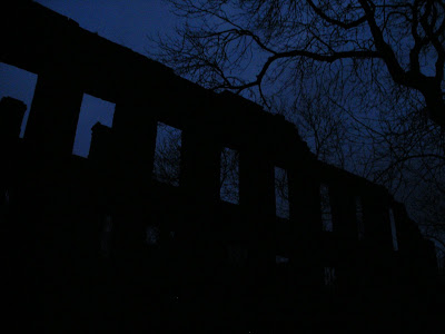
 Disused Mill just outside Stanbury. It was here we lost the light, the path and finally the plot.
 It had a bit of a "Bates Motel" look about it.
Unfortunately, just north of Stanbury near the old mill we ran out of light. Not too bad if you know the particular area you're in quite well, but if like us you don't it's easy to miss the footpath, go the wrong way, climb a clay bank in the wet and dark and have it collapse below you having you hang onto a tree branch for dear life, almost castrate yourself climbing over a couple of fences then finally see a way to Stanbury along a farm track which resembles The Somme c.1916, squelch your way there in the pitch black rather than use headtorches as you don't want the farmer in the nearby illuminated barn working on his tractor to see you trespassing, before realising when you reach the road that in fact you'd inadvertantly found the footpath again.
Still, Sausages and Mash and a pint of Jennings at the Haworth Old Hall compensated a bit...
 (Image produced from the Ordnance Survey Get-a-map service. Image reproduced with kind permission of Ordnance Survey and Ordnance Survey of Northern Ireland.)
VIDEO:


3 comments:
Carl - there's an earlier entry in your blog which talks about "The Cleveland Way" public information film. I'm trying to track down the film, and your blog has a youtube video of it, which is unfortunately no longer available. Do you know where I can find it? Many thanks.
Michael - Thanks for the heads-up on the video being down, it was on somebody else's Youtube account so I hadn't noticed. Fortunately I took the precaution of ripping it and I've re-upped it, you can download a copy here:
The Cleveland Way
Happy viewing!
Fantastic! It's years since I saw that. Many thanks.
Post a Comment